

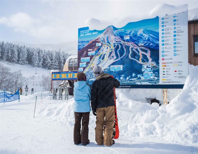
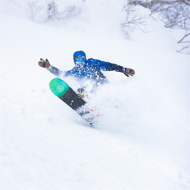
Niseko Maps
There are Niseko maps available including resort trail maps and village maps for the main accommodation areas, to make it easier to navigate both the mountain and the village.
Trail maps show runs by difficulty, lift locations as well as showing the Niseko gates for backcountry access. Village maps show accommodation, lift bases, restaurants and transport routes in Hirafu, Annupuri and Niseko Village.
Download Maps for:
- Resort Trail Maps
- Village Area Maps
- Bus Maps & Timetables

Niseko United Map
The Niseko United map shows the full layout of the four interconnected resorts, highlighting lifts, runs and resort links to help you plan where to ski on the mountain.
View Niseko United Map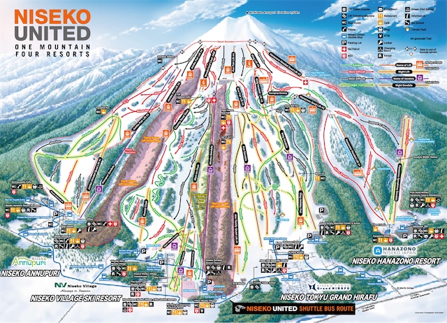
Hirafu Village Map
The Hirafu Village map shows accommodation, restaurants, shops, Niseko United shuttle bus stops and key landmarks in Hirafu.
Download Hirafu Village Map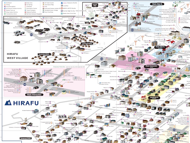
Niseko Rules Map
The Niseko Rules map explains the official gate system and safety guidelines for off-piste and backcountry access. Understanding these rules is essential for skiing and riding responsibly.
Download Niseko Rules Map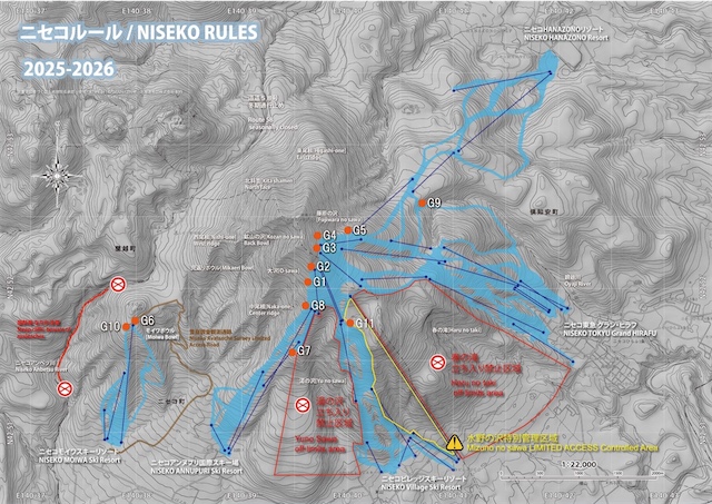
Niseko Moiwa Map
The Niseko Moiwa map shows the lift network, runs, backcountry gates and base facilities of the ski area.
Download Niseko Moiwa Map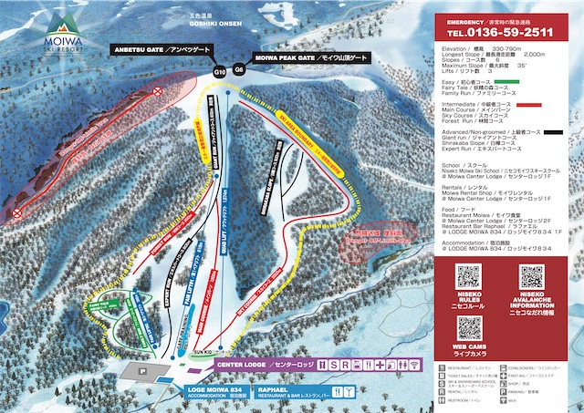
Hirafu Free Village Shuttle Bus Map
The Hirafu Free Shuttle Bus Map shows all village shuttle routes, stops and the timetable for the Hirafu Night Bus. You can track the live location of the village shuttles here.
View Live Bus Map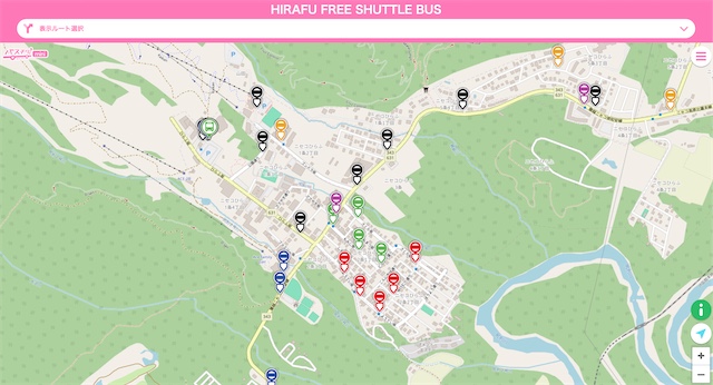
Niseko Transportation Timetable
The Niseko Transportation Timetable show shuttle routes and schedules linking Hirafu, Niseko Village, Annupuri, Hanazono and Kutchan, making it easy to get to, from, and around the resort.
Download Niseko Tranport TimetableNiseko Guides & Information


Frequently Asked Questions
Which map should I use for skiing in Niseko?
Use the Niseko United trail map to plan your skiing. It shows all four interconnected resorts, lift locations, run difficulty and the gate system across the entire mountain.
What does the Niseko United map include?
The Niseko United map includes Grand Hirafu, Hanazono, Niseko Village and Annupuri, showing how the resorts connect, where lifts and gondolas are located, and the layout of beginner, intermediate and advanced terrain.
What are the Niseko Rules?
The Niseko Rules outline the official backcountry gate system and safety guidelines for leaving marked runs. There are 11 gates in Niseko that access the backcountry terrain outside of the Niseko United resort boundaries.
Is Niseko Moiwa part of the Niseko United map?
No. Niseko Moiwa is a separate ski resort with its own map, lifts, facilities and lift pass. It is located next to Annupuri but operates independently from Niseko United.
How can I get around Niseko without a car?
It’s easy to travel around Niseko without a car by using the shuttle buses. The Hirafu Village and Village Shuttle maps show shuttle routes connecting Hirafu, Niseko Village, Annupuri, Hanazono and the free Hirafu Village, making it easy to travel between ski areas and around the village.
Where can I find backcountry access points on the map?
Backcountry access gates are marked on the Niseko United trail map. Always check current conditions and follow the Niseko Rules before using any gates.
Are printed maps available in Niseko?
Yes. Printed trail maps and village maps are widely available at lift stations, tourist information centres, hotels and ski rental shops throughout the resort.
Still Have Questions? Our specialists are here to help
Fill out an enquiry form to get in touch with our friendly team.
Contact Us